Most people ask the wrong question about Snowdon.
It is not “am I fit enough to climb it.” For a reasonably active adult on a settled day, the answer is usually yes.
The better question is which way up.
Six walking routes lead to the summit, and they are not the same walk. One is a long, steady plod beside a railway. Another climbs out of a high pass with a sniff of scrambling near the top.
Pick the route that suits your group and the day, and Snowdon is a wonderful hill. Pick the wrong one and it can feel grim, or worse.
Here is how to choose.
First, the mountain itself
Snowdon, or Yr Wyddfa in Welsh, stands at 1,085 metres (3,560 feet). That makes it the highest mountain in Wales, and the highest in the British Isles south of the Scottish Highlands.
Every walking path ends at the same summit cairn. There is a café and a railway station up there too, because the Snowdon Mountain Railway runs to the top from Llanberis. That surprises some first-timers. It also means the summit can be busy on a fine summer day, whichever quiet route you took to reach it.
The routes differ in length, in how steep they are, and in how exposed they feel. What they share is a serious top. The summit is a real mountain environment, colder and windier than the car park, and the weather can change fast.
The quick version
If you want the short answer before the detail:
- Most forgiving, first time, mixed group: the Llanberis Path.
- Shorter and more dramatic, happy on rough ground: the Pyg Track.
- A gentle start by the lakes, then a sting in the tail: the Miners’ Track.
- Quieter, with a bit of an edge: the Rhyd Ddu Path.
- Quiet and steady, away from the crowds: the Snowdon Ranger Path.
- Longest climb, strong walkers only: the Watkin Path.
Now the detail.
The Llanberis Path

This is the one to choose if you are unsure. It is the longest way up, at around nine miles there and back, but also the gentlest underfoot. It follows the line of the mountain railway on a wide, clear track, so the gradient is steady and you are never far from help.
That length is the catch. It is a long day, and the steady gradient means few flat stretches to rest tired legs. Allow five to seven hours.
For a first Snowdon, a family with older children, or anyone who wants the most predictable route, the Llanberis Path is hard to beat. Start in Llanberis village.
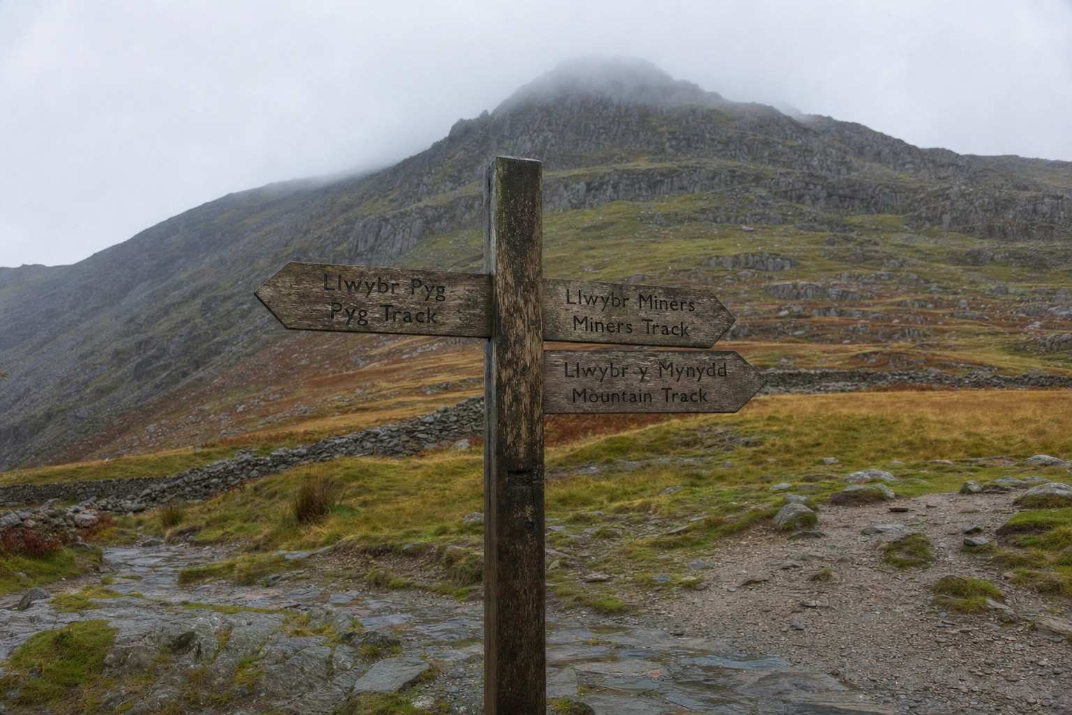
The Pyg Track
Shorter, steeper, and the most scenic of the popular routes. It starts high, from the Pen-y-Pass car park, so you do less total climbing than the length suggests, around seven miles there and back.
The trade-off is the ground. The Pyg is rocky and uneven, with a steep, stepped pull near the top where you may use your hands on the rock. None of it is a scramble, but it is no place for road trainers or wobbly knees.
If you are comfortable on rough, rocky paths and want the best views for your effort, the Pyg is the route most regulars pick.
The Miners’ Track
The kindest start of any route, and a good one for confident families. It also begins at Pen-y-Pass, but the first couple of miles are nearly flat, running past the old copper-mine ruins and the lakes of Llyn Llydaw and Glaslyn. Children love this part.
Then it changes character completely. The track rears up in a steep, rocky climb to join the Pyg Track for the final push. Many walkers go up the gentle Miners’ and come down the same way to avoid that steep section in descent.
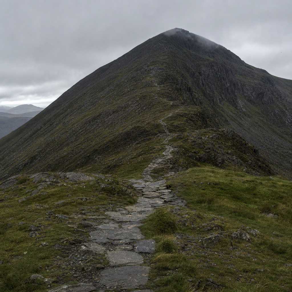
The Rhyd Ddu Path
A quieter route with a touch of drama. It climbs from the village of Rhyd Ddu on the western side, around seven and a half miles there and back, and you will share it with far fewer people than the Pen-y-Pass routes.
One thing to know. The upper section runs along a narrow ridge called Bwlch Main, with steep ground falling away on either side. In good weather it is a fine, airy walk. In high wind or poor visibility it is unnerving, and not the route for a nervous first-timer.
The Snowdon Ranger Path
The steady, underrated choice. One of the oldest routes on the mountain, it starts from Llyn Cwellyn and climbs at a consistent, manageable angle, around eight miles round trip. It is rarely crowded.
There are no real surprises here, no narrow edges and no scrambling, just a long, honest climb. If the Llanberis Path appeals but you would rather not share it with half of North Wales, this is your route.
The Watkin Path
The biggest climb on the mountain, for strong walkers only. It starts lowest of all the routes, in Nant Gwynant, so although it is a similar distance to the others you climb more than a thousand metres from bottom to top.
The final section is the sting. It crosses steep, loose ground below the summit where the path is faint and easy to lose, and many people find the descent harder than the climb. Save the Watkin for when you have a Snowdon or two already in your legs.
One route that is not a walk: Crib Goch
You will see Crib Goch named on maps and talked about online. It is not a walking route, and you should not treat it as one.
Crib Goch is a knife-edge rock ridge, a Grade 1 scramble with long drops on both sides. People are hurt on it every year, often in descent or in bad weather. It is a serious undertaking for experienced scramblers with a head for heights, the right skills, and settled conditions.
If you are reading a beginner’s guide to choosing a path, Crib Goch is not your route this year. There is no shame in that. It is simply a different sport.
Before you set off
Choosing the right path is most of the battle. A few practical things decide the rest of the day.
Parking goes early. Pen-y-Pass is small and fills by breakfast time in summer.
Book a space ahead if you can, or take the Sherpa’r Wyddfa bus that links the main start points. The Eryri (Snowdonia) National Park Authority publishes current parking and bus details, and they are worth a look before you travel.
Check the mountain weather, not the town forecast. The valley can be calm and mild while the summit sits in cloud and a cold wind. Read the mountain weather before you go, and take what it says seriously.
Carry the right kit, and know when to stop. Even on the easy routes you want proper footwear, a waterproof, warm layers, food, water, and a way to navigate. Our guide to what to pack for a day in Snowdonia covers the lot without the upsell.
And if the cloud is down, the wind is up, or someone in the group is struggling, turn back. The summit will still be there next time.
If Snowdon itself feels like a step too far for now, that is fine. Start with one of these beginner-friendly walks in Snowdonia, build your hill legs, and come back to Yr Wyddfa when you are ready.