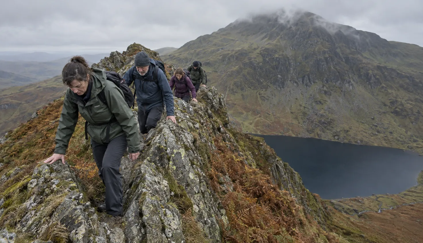
It is easy to plan the Snowdon Horseshoe as a long path. Crib Goch, its first ridge, is a scramble.
It asks you to use both hands and feet on rock, with steep drops on both sides. Without scrambling experience, the Horseshoe is not the right day out.
The route and its numbers
The Horseshoe is 11.7 km long with 1,176 m of ascent, according to Ordnance Survey (OS). Its time of about 5 hours 30 minutes leaves out stops for food or rest.
Plan for 6 to 10 hours, the range the British Mountaineering Council (BMC) gives, depending on your scrambling speed and fitness.
The circuit starts and finishes at Pen-y-Pass. It runs in this order:
- Start. Up the Pyg Track to Bwlch y Moch (the Pass of Pigs).
- The ridges. A sharp turn right onto Crib Goch, then along Crib y Ddysgl.
- The summit. Yr Wyddfa, the Welsh name for Snowdon, at 1,085 m.
- First descent. The top section of the Watkin Path, down to Bwlch Ciliau.
- Last scramble. Y Lliwedd.
- Return. The Miners’ Track back to Pen-y-Pass.
The Pyg Track and the Miners’ Track each have their own page.
How hard it is, and who it suits
The Eryri National Park Authority says Crib Goch and Crib y Ddysgl are both Grade 1 scrambles. That means elements of rock climbing, with hands and feet in use at the same time.
Grade 1 is the lowest rating on the scrambling scale, the BMC says. It also warns that Crib Goch is often underestimated and that the exposure is serious.
Crib Goch is a knife-edged ridge with steep pinnacles and steep drops on both sides. The exposure often leaves walkers “crag fast”, stranded and unable to climb up or down.
Accidents are common, many people need Mountain Rescue, and there have been fatalities.
OS calls the Horseshoe “narrow, high, hands-on and for many the best walk ever, but for some just too scary”. It says only experienced walkers with steady nerves should tackle it.
Adventure Smart Wales says Crib Goch is “definitely not a walk” and involves unroped rock climbing above big drops. If you are not an experienced scrambler, it says, Crib Goch is not for you.
You are ready for the Horseshoe if all of these are true:
- You are an experienced scrambler, with easier scrambles behind you.
- You stay steady with steep drops on both sides.
- You can navigate, because route finding is not straightforward.
- You are fit for a day of 6 to 10 hours.
- The forecast is dry, calm and clear, with no snow or ice.
- You are not bringing a dog. Eryri says dogs should not be taken on this route under any circumstances.
Crib Goch and Crib y Ddysgl
From Pen-y-Pass you follow the Pyg Track, then turn sharp right at Bwlch y Moch towards Crib Goch. Crib Goch is not a primary route to the summit.
Adventure Smart Wales tells Pyg Track walkers to stay on the path and not to turn right, thinking they are heading for the top. Turn right only if you mean to scramble.
Crib Goch is a 500-metre knife-edge ridge with no escape route. The first way off is Bwlch Coch, by a steep, grassy descent that rejoins the Pyg Track.
Read what Crib Goch asks of you, and who should not go on it, before you set out.
After Bwlch Coch the route continues along Crib y Ddysgl. The BMC says the easier route below the crest still needs good route finding and navigation. Staying on the crest is just as challenging as Crib Goch.
Crib y Ddysgl is a second Grade 1 scramble, not a rest after the first.
The summit and Bwlch Glas
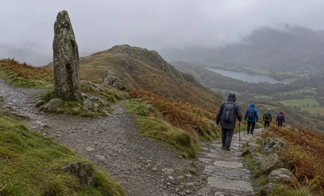
The Pyg Track merges with the Miners’ Track and joins the Llanberis Path at Bwlch Glas, then continues to the summit.
Bwlch Glas is where the Horseshoe can end early. The Pyg Track and the Miners’ Track both lead back to Pen-y-Pass.
The upper half of the Miners’ Track, above Glaslyn, is steep, with loose rock and scree. Go down it with care.
On the upper Pyg and Miners’ Tracks, stay high until you reach a prominent standing stone, some 3 m high.
It marks the junction of the two tracks, and the paths are difficult to follow in fog or mist.
Do not count on shelter at the top. In bad weather the summit railway and café are frequently closed, and they are never open in winter.
Adventure Smart Wales says it is best to turn back rather than carry on hoping for shelter.
Leaving the summit for Y Lliwedd
Do not take the direct line off the summit.
A direct line over the top of Clogwyn y Garnedd is easy to take, but it leads onto a treacherous scree slope. It has caught people out, sometimes with tragic results, the BMC says.
Adventure Smart Wales describes a similar mistake on the East Ridge. Walkers follow what look like eroded paths towards Y Lliwedd, but they are sheep trails that end above a very big drop.
It says this direct route is very dangerous at all times of year. Falls there are frequent, with tragic outcomes.
The safer way, Adventure Smart Wales says, is to head south from the summit until you reach a standing stone. Only then turn left (east) onto the Watkin Path, down to Bwlch Ciliau, and carry straight on to Y Lliwedd.
Y Lliwedd has more exposed scrambling, after the ridges and the summit. Route finding can be tricky coming off the mountain as well.
Time, parking and buses
Carry a torch in case you are caught on the mountain after dark. A head torch leaves both hands free for the scramble.
Between March and November, planning how to get to Pen-y-Pass in advance is essential. Eryri’s car park page says the car park is pay and display over the winter and goes back to pre-booking through JustPark at Easter 2027 (as read in November 2026).
A Horseshoe takes 6 to 10 hours, and extensions to existing bookings are not possible. Once pre-booking is back, book a slot that covers the longest day you might have. Drop-offs are allowed at Pen-y-Pass.
Sherpa’r Wyddfa runs the S1, S2 or S5 from Llanberis and Nant Peris to Pen-y-Pass.
The S2 runs from Bangor and the S4 from Porthmadog. The council’s timetable for 2 November 2026 to 19 March 2027 is a winter one. It lists no S5, and its S2 is headed Bangor, Llanberis, Nant Peris. From Llanberis and Nant Peris, the S1 goes to Pen-y-Pass.
The map for the Pyg Track is OS Explorer OL17 (Yr Wyddfa and the Conwy Valley).
Conditions that end the day
Eryri says Crib Goch is not suitable in wet and windy weather. It calls it a serious mountaineering undertaking in wet weather, wind, snow, mist or ice.
Three things make it worse:
- The BMC says high winds and slippery conditions can easily add a grade.
- The rock is polished in places, so it can be slippery even when damp.
- The exposure to high winds here can be fierce.
Read the mountain forecast before you go, and check the ground conditions.
If the weather starts to get too much for your ability, turn back immediately. Be honest with yourself about your knowledge, fitness and ability.
In snowy conditions the BMC calls Crib Goch a Grade 1 winter climb. It needs crampon and ice axe skills, and in winter on Snowdon it is best left to those with plenty of experience.
In an emergency, call 999 and ask for the police and the Mountain Rescue service.
We compile and explain public route and safety information. We guide nobody and sell nothing on the hill.
Where the day can still change
Five points let you change the day, in this order:
- Bwlch y Moch. Stay on the Pyg Track instead of turning right, if the ridge is wet, windy, misty or icy, or you are unsure.
- Bwlch Coch. Take the steep, grassy descent to the Pyg Track.
- Crib y Ddysgl. Use the bypass below the crest. It still needs good route finding and crosses steep terrain.
- Bwlch Glas. Go down the Pyg Track or the Miners’ Track to Pen-y-Pass.
- The summit. Decide here whether to go on to Y Lliwedd or return to Bwlch Glas and go down.
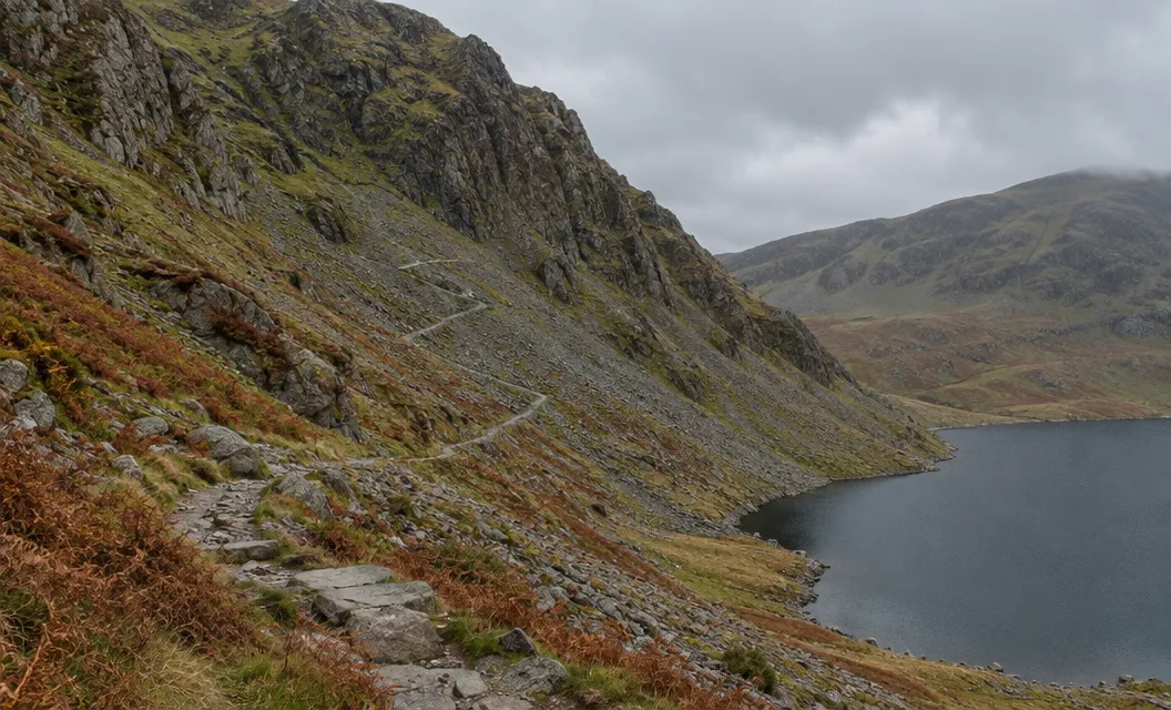
After Y Lliwedd the walk finishes on the Miners’ Track, which is relatively easy. The full Miners’ Track runs along the shores of Llyn Teyrn, Llyn Llydaw and Glaslyn.